Categories
Blog courses Culture Destinations Highlights Rendezvous Reverb Runner Resources Stehekin Rendezvous Territory Run Camp Rendezvous TRC trip report Trip Reports Trip Reports and Trip Styles Trip Styles

The Magic of Lodge Season

Fall comes early in the mountains. The fog hangs heavier over the valleys, the skies begin to welcome the familiar shifting clouds. The days are getting shorter, but there are still berry harvests to be had and some of the trail running’s most wondrous days awaiting. Aspire moves basecamp indoors to mountain lodges, turning up the cozy for a series of charmed autumn trips.


Last fall, I had the privilege of sharing in the magic of Territory Run Camp as a member of the Aspire staff. The luxury of having a lodge, as opposed to our usual outdoor glamping scene, was not to be understated in the midst of the many different types of weather we encountered. It’s quite difficult to imagine it was only a long weekend, the moments of run camp truly felt timeless. 

Settling into the lodge on the first night, we feasted on garlic toast and a hearty carrot-lentil soup, spiced to aromatic perfection. As night fell, runners retired to their bunks, only to be greeted with hot coffee and dutch pancakes at first light. 


These rendezvous trips offer runners many options for what kind of mileage or length of day they would like to have. As a member of the Aspire crew, we coordinate to ensure that each mile of trail a participant chooses to run is swept so that we can make sure everyone makes it home for dinner. 

On this first running day, I was lucky to get to run the traverse from Excelsior Ridge along the High Divide to Yellow Aster Butte. After a few steep miles, the trail breaks through treeline and leads you through miles and miles of blueberry bushes atop scenic rocky ridgelines with sweeping views of the valleys below. Throughout this particular day, the sky was with me. We moved together. Sweeping around turns in the trail and through small stands of cedars. The swirling mist rising from the valleys caught my gaze as a hawk took off from a nearby perch and swooped over a misty horizon. The colors of vibrant green moss, auburn red undergrowth, and pink bells of heather seemed to catch my eye more on this overcast and moody day. How awesome it is to move for hours and miles through these hills, feasting on plump huckleberries, knowing there is a smiling face, a bag of chips, and a cooler of beer awaiting my arrival at the trailhead.

The next day, NOAA forecasted an eighty percent chance of rain, offering us the clear decision to spend the day exploring the trails nearby to the lodge. Of these trails, there are mileage options anywhere from a few miles, to 20+ miles through beautiful mountainous terrain with alpine lakes, broad ridgelines, glacier views, and more. Some folks opted to run out towards Lake Ann and the west face of Mount Shuksan. Others ventured out towards Kulshan along the Ptarmigan Ridge. I decided to run an eight mile loop from the lodge, circumnavigating Table Mountain. The loop is one I have more often completed on skis, while there is a hefty blanket of snow covering the slopes. On this foggy day, with little spouts of rain here and there, I found so much enjoyment discovering the magic that this route holds in the summer months -–shimmering clear alpine lakes, waterfalls and meandering creeks, rock buttresses adorned in moss and lichen, boulder and scree fields with stones of swirly metamorphosed granite. 

The afternoon offered many a moment to connect with others at Run Camp as we all gathered to share stories, read books, and play cards or chess, while our gear dried downstairs. After dinner, we listened to a talk given by a veteran through-hiker named Bacchus. He offered his words of wisdom acknowledging the power of giving in to an “unfiltered” experience. He spoke of the magic that happens when you pay attention, and leave the distractions behind. He called into question the meaning behind why we run? –why we do the things we do? In his words, “It’s not about the miles or the gear, but how you have been changed by the experience.” He encouraged everyone to take a moment and consider our relationship to the external world –to see ourselves in context; in this moment, in this place, as this person. His stories and his message felt potent, and the questions he raised stayed with me through the night.

On the third day of running, we had the opportunity to choose between a climb up Goat Mountain, a trail up the riverbed to the Nooksack Cirque, a climbers trail to a lake at the toe of a glacier, or any combination of the three options. As a skier and lover of glaciers, I decided to explore the Nooksack Cirque and glacier fed lake. Emerging from the forest onto the large smooth cobbles of the Nooksack valley, I took note of my slowed pace. As I walked, the river wound, interrupting my route –- ushering me across and through its icy waters. Knee deep in glacial runoff, feet soaked with the ancient melt of glaciers… I felt a reverence come over me. The cirque remained out of sight –around a bend in the river– and so I walked on to get a view. Eager to witness the headwaters where the mighty Nooksack river originates. As the blue ice began to show, and the river curved towards the cirque, I felt a heaviness happen upon my chest. The thought crossed my mind, “Is this ALL there is?” …and soon after, “This is ALL there is!” How magnificent and how frail. How ancient and powerful! How withered and vanishing. 

In the moments that followed, I could feel the messages of Bacchus’s talk taking root in my mind. I could feel myself being overwhelmed with gratitude for an opportunity such as this, to feel human, to feel uncertain of the future, to fully feel any and all emotions that colored the next hours of my experience.


On the final day of Territory Run Camp, everyone awoke before first light and made our way up to the summit of Table Mountain to watch as the sun rose over the shoulder of the neighboring Mount Shuksan. Winding our way up the rocky switchbacks, we could see Kulshan in the distance, radiant in the blue hue of dawn. As the light began to change, a few solitary wisps of clouds became illuminated with orange and pink. The energy amongst the group was one of contentment and awe, underlain by a heightened sense of connection to this place; to these mountains. We were so fortunate to get to experience them in so many different temperaments: the moody days that turned to rain; the rain that turned to hazy sunshine; then to a final burst of sunshine on the clearest morning of all. Gratitude to this degree felt humbling.

To be offered such an opportunity as Territory Run Camp and a progression of experience is such a gift. I am so grateful for the running stoke, the exceptional food, and all the uplifting vibes from Aspire and Territory Running Co. And I also deeply appreciate the sense of adventure; of growing as a human; of discovering what it means to be in connection with wild places. Thank you, Thank you, Thank you! I’m already looking forward to lodge season next year!


Explore Territory Run Camp and the following lodge trips on the calendar this fall:

Stehekin Rendezvous

North Cascades Climate Summit

Territory Run Camp

Out Trails LGBTQ+ Running Retreat – North Cascades


Julie Ann leads Aspire’s mountain based skills courses and fastpacking missions, while also working as a mountain guide in the North Cascades, and teaching wilderness medicine courses.
Categories
Blog courses Destinations Highlights River of No Return Stage RNR Runner Resources Stage trip report Trip Reports and Trip Styles Trip Styles

Expecting the Unexpected, Pt. 2: Rolling with High Water

Wild conditions on the River of No Return Stage

The 2022 Aspire calendar boasted our very first multi-sport trip, a raft/run excursion down Idaho’s remote and legendary Middle Fork of the Salmon River. As the lead guide for the trip, I had long been looking forward to a week away from cell service in the Frank Church-River of No Return Wilderness, collaborating with the river guides to create a unique experience for our runners and their families on the boats. By June, however, it was clear that conditions in the mountains had other ideas.


Flood Stage

A week before we were set to launch, runners received an email from Kelsey Helfrich, owner of Helfrich River Operators, explaining that with the surrounding mountains at 300% of average snowpack, the river was running at 6.5 ft, … dangerously high. Due to the increased safety risks associated with high water (more intense rapids, debris in the river, and with these an increased risk of drowning), they were canceling the trip. Given that the search was still on for the body of a rafter who’d attempted the river a week before, the cancellation was hardly worth questioning. 

Immediately my phone began to buzz with an incoming call from Abram (Aspire Course Director).

“What do you think of an air-supported alternative?” he asked.

“Like, we get heli-dropped?!” I responded, immediately intrigued.

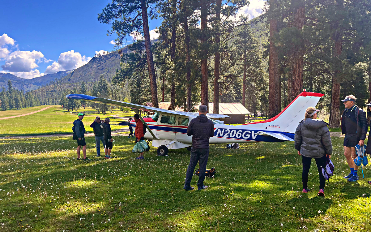
The plan he proposed involved using Bi-planes supplied by Sawtooth Flying Service to drop runners off at one of the primitive airstrips which dot the river to access the basecamp and trail system for four days of exploring.


“This sounds like a PROPER adventure! Let’s do it.” I replied. 

Abram laid out the options for participants: runners could use trip insurance to reimburse their trip, take a partial credit that could be put towards a future trip, or join us for the air-supported alternate trip that promised to be both unique and wild. We needed only 6 runners to say yes to the plan and by the end of the night, we had 8. We were going to Idaho.


Preparing for Take-off

Stanley, ID is a tiny town set in a sweeping valley under the jagged Sawtooth Mountains. The power of the Salmon River pulses through this town: its bars crowded with river guides and its streets dotted with outfitters. This infectious energy makes it a perfect jumping off point for adventure. 

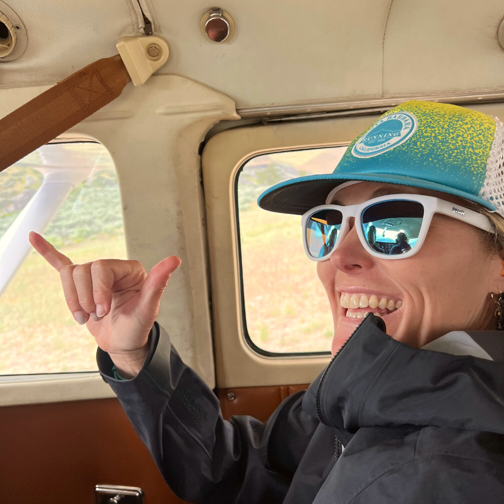
Runner’s met up at the back porch of River One Outfitters, looking over the rushing main fork of the Salmon River for orientation with the river guides. Evening presented the opportunity for a visit to Mountain Village Resort’s private hot spring, and runners returning from the pools wore that spiritually refreshed look that only the inner Mountain West can offer. After a quick stop at the Stanley Bakery, a refreshingly modern cafe featuring quality baked goods, runners showed up on the runway energized, looking toward the distant Sawtooth Range with anticipation. During orientation, Kelsey had informed us that Sawtooth Flying was her first choice for flights through the region because “she prefers pilots who know what they’re doing over pretty planes and clueless pilots.” Indeed, this squad of pilots had seen some time in the air, as had the planes. Anticipation and nerves were palpable as the pilots loaded our baggage and divided the group by weight into the small prop planes. As opposed to larger passenger planes, you can FEEL the force as these planes take off. White knuckles gripped seatbacks as our planes took off and rose over Stanley toward our 26 minute flight to Pistol Creek.


Heading Down River

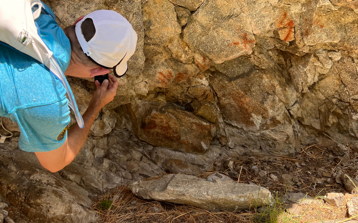
Petroglyphs along the Middle Fork of the Salmon River

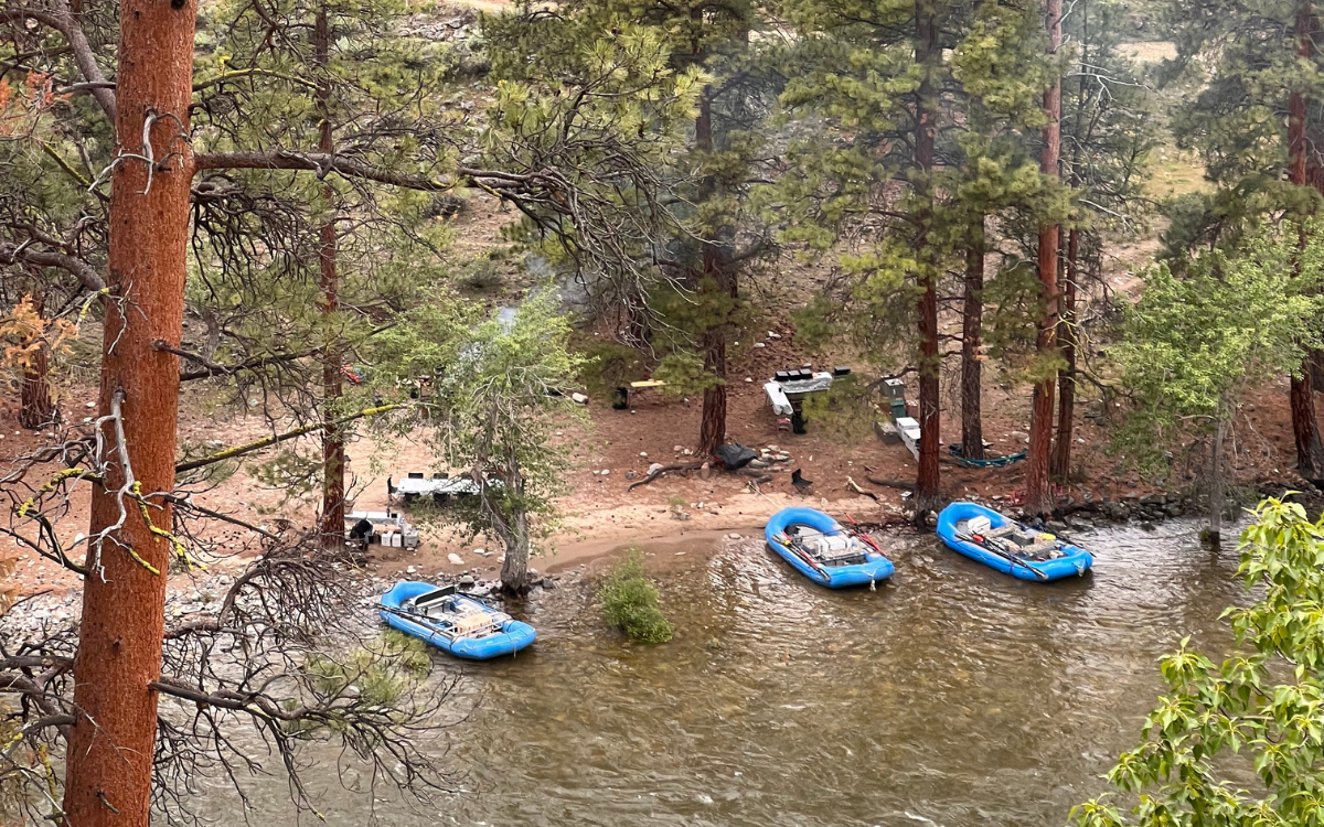
Our initial run took runners ~15 miles down river from Pistol Creek to our basecamp at the Little Creek Campsite. These were CRUISER miles, almost exclusively downhill along the river, with side canyons to explore and eddies for dipping in when runners needed a break from temps in the upper 70’s and low 80’s. Side canyons offered mines to explore and petroglyphs to investigate. At basecamp we foundTim Gunderson, the lead for Helfrich’s team of river guides who was cracking into appetizers and slicing salami as we rolled in. The rest of the river guide team had braved the more treacherous reaches of the upper middle fork for a High Water Training, bringing the tents and kitchen equipment down with them. They arrived that night and unpacked camp like they could do so with their eyes closed. With their whole team at camp for the evening, I started up conversations with the guides about the surrounding high country. 


Planning for the Unknown

The joy and challenge of this unplanned reroute was gathering beta on Idaho’s notoriously remote and rugged backcountry and transmuting that information into an enjoyable experience on trail for the runners on the trip.

As the saying goes, “the map is not the place,” and the river guides held most of the knowledge I would be able to glean before heading out for the week’s excursions. As we sat down to dinner, I presented our routes to runners, providing the details and information I’d been able to gain and deduce from studying maps and probing the guides about their experience on land through the Frank Church/River of No Return Wilderness.

Our next three days would be filled with exploratory runs up canyons to ridgelines we had scouted only days before, and only on Gaia GPS’s online mapping software. We laid out the week to gather information as we went. Our first day’s route would tell us a lot about conditions in the canyons, and snow levels up on the ridgelines. Day 2 offered a 14 mile run to the Mahoney Creek Lookout which we could see was snow free from camp and from which we could gather quality beta for the following day’s route up to the ridgelines across the river. Depending on Thursday’s beta, runners were provided with two options for the final day: an exploration up the Marble Creek Drainage and return for an afternoon in the hot springs, or a larger exploratory run up Cougar Creek, covering  27 miles of Idaho wilderness, incurring 6700’ of elevation gain and some sections of  “mystery”  trail on which we had no beta.

With runner’s prepped, we spent the night enjoying the company of the river guides and the sound of the river before turning into our tents. Adventure awaited. 


Route #1

As we took off up Thomas Creek the following morning, we passed a work crew setting off on the trail who warned us of landslides up the trail, before expressing excitement about gathering beta from us after our return. We came to the landslide about a mile on, the side of the hill crumbling downhill into the river, but runners made quick work of the obstacle before continuing on. 

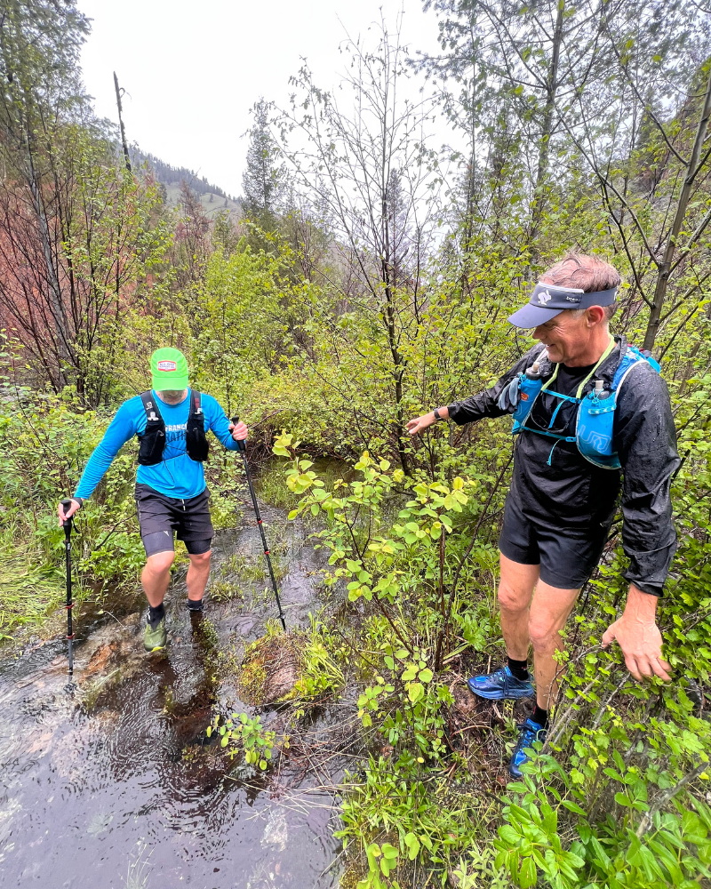
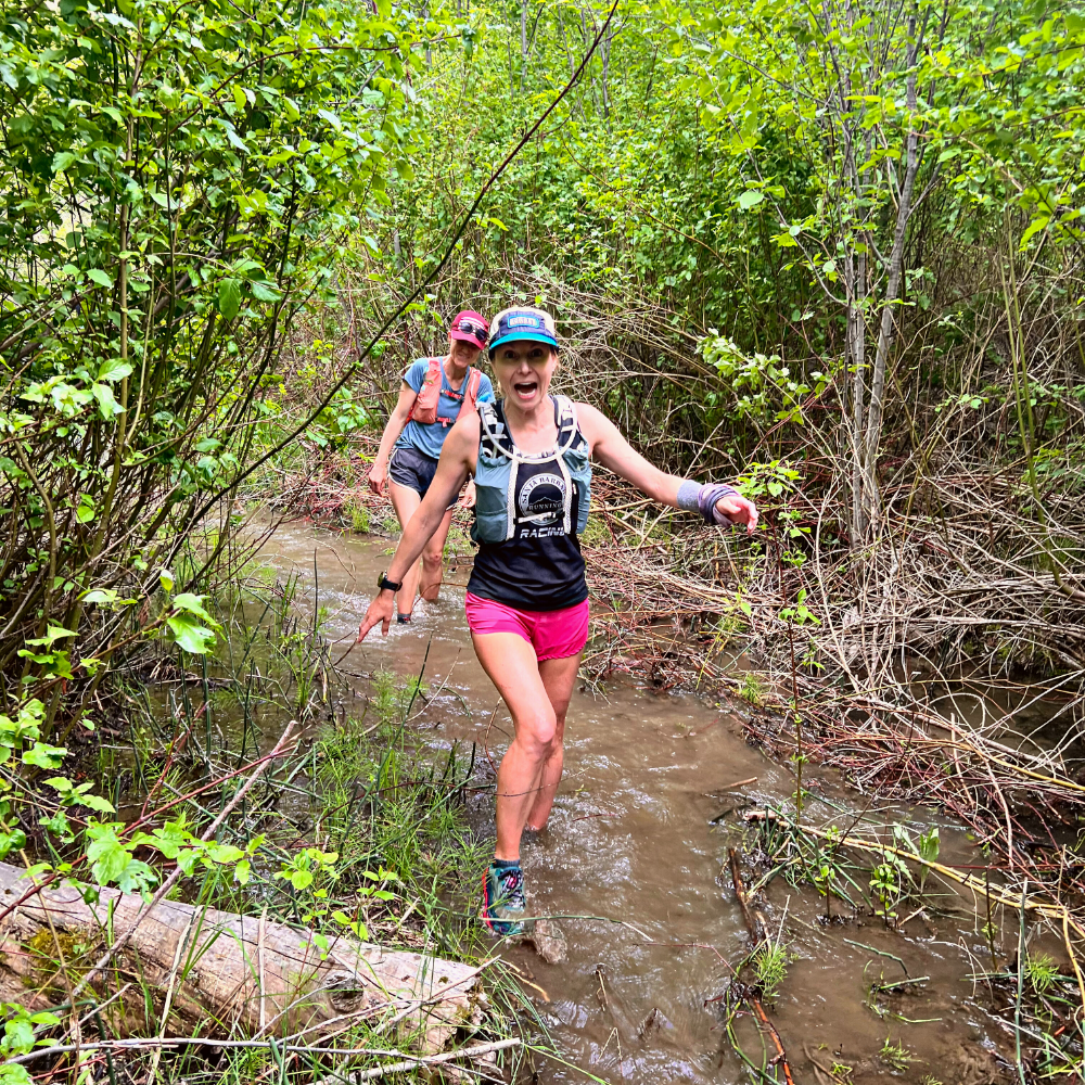
Crossing Thomas Creek there was no choice but to plunge into rushing knee deep water  Wet feet would prove to be the name of the game as the trail continued alternating between rock, mud, and becoming a creek itself. 

Navigating the Thomas Creek Trail

“Are we having fun yet?” While it was certainly an adventure, bushwhacking through thick shrub in ankle deep water is not everyone’s idea of a great time. Following the check in and a reminder that hotsprings awaited for anyone who wished, the group split up, with a small group continuing on the route, and the rest returning to camp for lunch and a soak in the springs. 

For the three of us that carried on, the trail eventually climbed away from the creek up the dry hillside of a burn zone, where we were able to pick up the pace for a few miles before breaking at the junction of two drainages for a snack. As we sat and enjoyed the sun, something caught Adam’s eye.

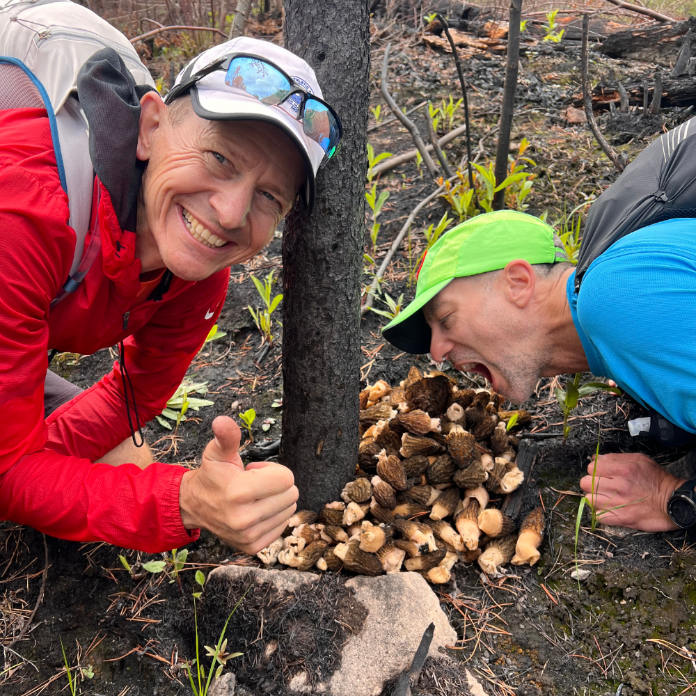
 “Morels!”

Indeed, hundreds, no, thousands of them! 

Morels!

There’s a defined THRILL to discovering a patch of morels, and the pure volume we were looking at pulled us into an hour of foraging the hillsides. We collected more than four pounds and tied them up in my Houdini before continuing to explore up the trail for a few miles more.

We didn’t make the ridgeline that day to complete the loop, but we learned a few things: the morels in the Thomas Creek drainage are profoundly plentiful, and the Idaho backcountry is rugged, not inclined to give up miles without a fight.


Route #2

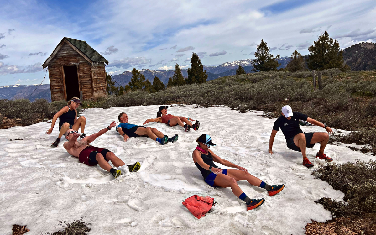
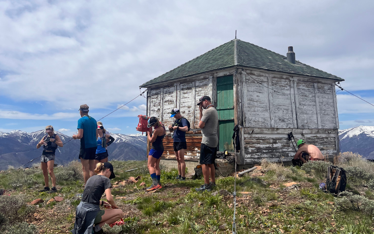
Snow angels at the Mahoney Creek Lookout

Day Two’s plan was clear cut: follow the trail above camp up along the ridgeline to the lookout, soak in the views, and then return to the river for hot springs and food. Fortunately, the ridge trail was clear of the shrubs and brush that had made travel on the previous day’s route tedious, and was instead covered by a brilliant showing of wildflowers. We climbed the seven miles to the lookout as the Idaho sun shone across the vibrant mountainsides of the Sawtooth Range.

From the lookout, we were able to confirm that ridges we had been considering for the final day’s route would go… minimal snowfields and promising open mountaintops awaited.

On the descent back to the river I took a detour and swung through camp, swiping cold beverages and snacks and packing them out to a birthday party soak at the Sunflower Flat Hot Spring. The springs, redubbed “Gucci Springs” by the group, feature multiple soaking pools 10’ above the river, and a steamy waterfall that drops directly into the Middle Fork… a place I’ll return to in dreams when the PNW’s drippy, cold winter rains set in. 


Route #3

On Day Three the group split, with the party pace squad heading up Marble Creek and enjoying some extra time at “Gucci Springs”, and the motivated runners heading out for 27 miles of unscouted trail up Cougar Creek to the ridgeline, and then out the Little Loon drainage back to camp. 

I went out with the motivated squad and rambled down 5.5 miles along the Middle Fork. Each corner unveiling new rock formations and gorgeous hillsides. Reaching Cougar Ranch brought us to our climb up to the ridge – 7 miles and 4,100’ of climbing and we would make the ridgeline that had called to us all week. After the long, sun-exposed climb, we reached the ridge at  7400’ and the mountain breeze cooled us off. We enjoyed several miles of ridgeline runned to Castle Rock, and the beginning of our downhill out the Little Loon drainage back to camp. 

The “trail” in the lower canyon following the first creek crossing.

Mountain runners often expect the downhill to be generous with the clock, allowing us to cover ground quickly and find our flow state. Almost immediately after dropping down off the ridge, it became apparent this would not be the situation for us. The trail quickly feathered as we passed through a burn zone, and we began more active navigation as we picked the best lines through Idaho’s sharp, pokey undergrowth. This proved to be slow going, but as we reached the canyon bottom and joined up with the Little Loon trail, we held up hope for clearer travel ahead.

It would not be so. 

Little Loon Canyon was gorgeous, a braiding “creek” winding through an idyllic valley, but the trail down the canyon crossed the creek many times. Water levels at this point were still rising, and had turned the creek into a rushing torrent none of us were keen to cross. Avoiding the crossing meant bushwacking and scrambling boulder fields alongside the creek, navigating landslides, and praying the rattlesnakes had taken up residence elsewhere for the day. Treacherous as this was, we continued downstream avoiding the crossings, sometimes traveling only 1 mile per hour.

Then the canyons began to close in, and I could see on our topo map profile that the creek would pass through tight channels with cliffs on either side. A few miles from our junction with the Middle Fork Trail, the terrain asserted its will, forcing us into a crossing of the creek.

I stepped into the flow and felt the icy waters wrap around my scraped-up legs and rise to my waist, choosing a line where the river was wider and without holes and boulders.  I signaled to the group to unstrap their chest straps and link up, pointing to our exit on the far side of the crossing, and in we went. The flow was strong enough to make crossing a challenge for the lighter members of our group, but we crossed without incident. Having broken the threshold, the next few crossings proved, while still challenging, less imposing. We utilized what nature provided, propping downed trees across the creek for stability and supporting each other, only to dive back into the brush on the other side. When the trail finally spit us out onto the junction with the Middle Fork Trail, our group laughed, cried, and swapped high fives. We had just passed through some proper type two fun, and the bonds that formed while waist deep in the creek were palpable now that we were out of the thick of it. I sent an Inreach message to the team back at the campsite, “These runners are going to want showers tonight, eta 90 minutes”, and we took off. It had been an epic day.


Unexpected Magic

While recounting our adventures over dinner back at camp, the river guides let us know that a storm was moving in, bumping our pick-up time for the flight out of the canyon up to 11am. We planned for our run downriver to the pickup spot accordingly, setting alarms and packing up before bed. Upon awakening in the morning, however, we learned the storm was pushing in more quickly and after conferring, we decided to forgo the days run in exchange for a pick-up directly from camp, rather than risking the storm making pick-up impossible downriver and trapping us on the river for 2-3 extra days. 

What was one more alteration during this freewheeling week of adventure? By the time the pilots made it onto the Thomas Creek airstrip, the storm was right on their heels, making for an exhilarating flight out through rain and sleet in the six-seater planes, but we got there in one piece, stepped foot on terra firma and concluded a trip full of incredible moments.

Departing from the scheduled itinerary opens us up to new experiences by default, and the exploration and celebration on the Middle Fork this year made for an incredible reward for the risk. The squad of runners who joined for the alternate River of No Return trip this year were down to roll with the unexpected, thus experiencing the magic of the Middle Fork in a unique way. 


Explore the River of No Return Multi-sport Stage Run.


Trent Banks is a senior guide and marketer for Aspire, as well as a DJ and event producer, and father of two daughters, based out of Bellingham, WA. He joined the Aspire crew in 2018.

Listen to his Spirit Ventures DJ mix series, inspired by and made for trail running.

Categories
Blog courses Destinations Highlights LCT Lost Coast Trail Stage Runner Resources Stage The Adventure Ethic trip report Trip Reports Trip Reports and Trip Styles Trip Styles update Wild

Expecting the Unexpected, Part #1: What Happened up Buck Creek

Adventures in Risk Management on the Lost Coast Trail

Risk management is a cornerstone of Aspire operations. Each trip’s unique variables call for a different approach to keeping runners safe and ensuring an enjoyable experience. Even so, when running through wilderness environments, nature makes the final call. Our “Expecting the Unexpected” series recounts times when things didn’t go according to plan, and the unique opportunities for bonding and adventure those moments create when risk is managed well.


There’s a mercantile in Leggett, CA, (population 56) that serves as a meet-up point and final outpost for adventurers heading off the grid and into the remote coastal wilderness. The shop offers basic provisions like you’d expect. It also sells a green-brimmed hat with a punchy message about the picturesque and famously twisted route nearby: “I survived Highway 1.”

A more accurate hat might say: “I survived Aspire’s Lost Coast Trail Run.” 

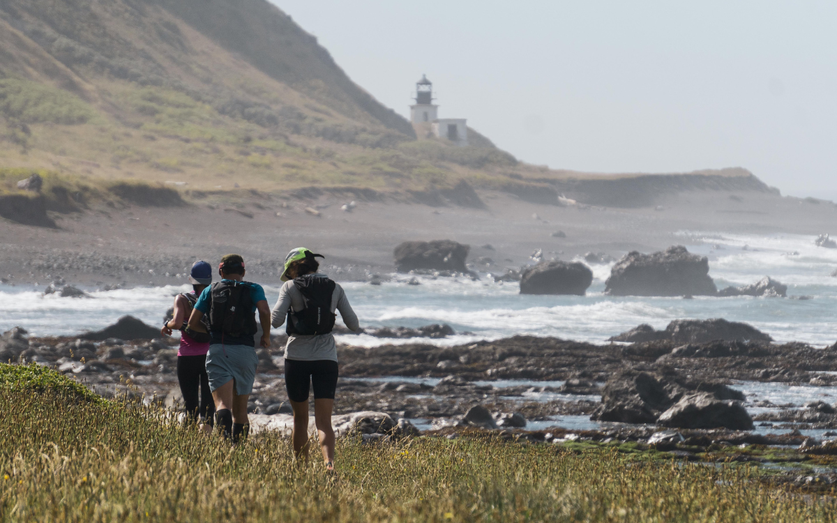
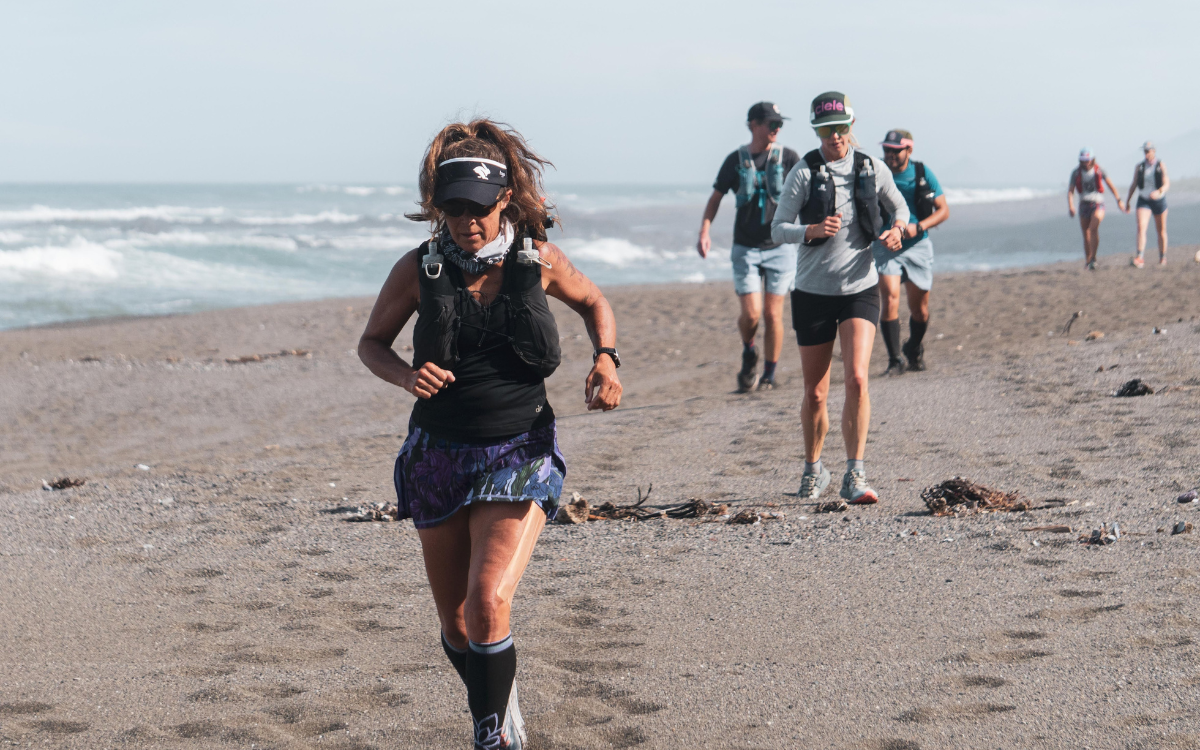
Running through sand, the joy of any beach trek.

It’s a given that things go wrong on long-distance backcountry excursions. Runners might like to focus on physical strength and race tactics. But problem-solving is the core of ultrarunning and outdoor adventuring. With the right mindset, risk management plan and a bit of luck, getting out of that tough time is also the root of the story everyone shares at the end-of-trip campfire. 

At least that’s how it went on Aspire’s unforgettable June trip along the Lost Coast.

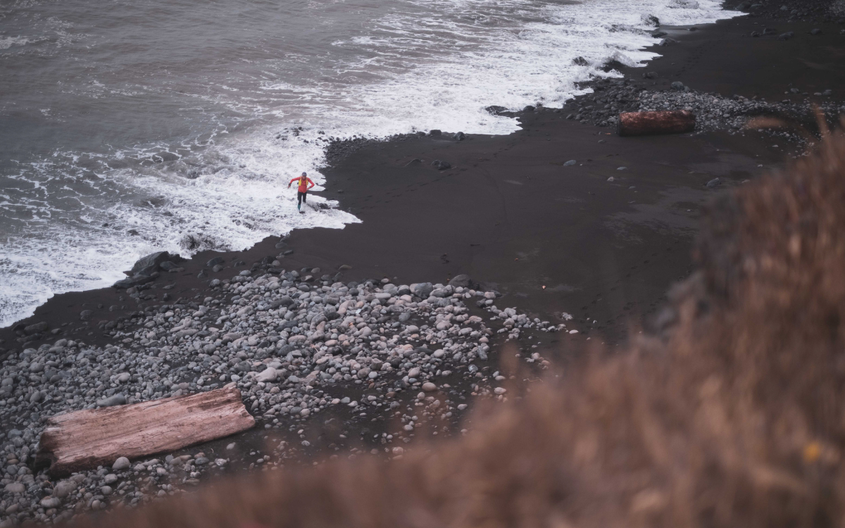
A runner dodges the tide.

A three-hour’s drive north of San Francisco, this remote and wild slice of the King Range National Conservation Area and Sinkyone Wilderness feels more like a scene out of Jurassic Park than a protected patch of land in the most populous U.S. state.

Cell signal? Forget about it. Roads? Hope you don’t get car sick, don’t have to pass anyone, and have an hour or three to get where you’re going. People? Mostly just backpackers doing a sandy 25-mile beach trek in several days — a section Aspire runners will be covering on Day 1. And then there’s the thistle-berry-poison-oak bushwhack interspersed along the 60-mile route. 

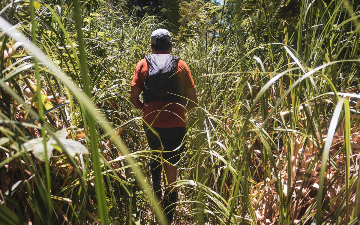
Infamously brushy sections abound on the Lost Coast Trail.

The 19th century Gold Rush brought death and disease to the indigenous Sinkyone people here. Then, timber harvesting and oil drilling carved up the land and left behind sawed-off redwood stumps and squiggly roads that seemingly go to nowhere. When the oil boom dried up in the 1930s, people left the region in droves, giving it the apt name. But by hour five on a trail here, it’s reasonable to think that the bluffs just don’t want to be found.

If things have to go sideways in such remote places, one hopes it’ll be something relatively minor. An irked knee after a 25-mile day on a slanted sand beach, perhaps, or a bent tent pole while rushing to pack up camp in the pouring rain. They’re the kind of things that in the moment can — and do — feel crushing. Managed with a well-stocked tool kit and a bit of know-how and they just become part of the experience. 

Where the real strength shines is when something bigger happens, when things really start to go off-script, and when a group is tested in bigger, more complicated ways. 

Welcome to Day 1.

The Lost Coast run begins with a near-marathon-length run through deep sand, slick rocks and precarious bluffs spanning Mattole River Campground to Shelter Cove. The route has three tide-dependent crossings that runners must traverse before a certain time or else risk being cut off from the trail until the water recedes. The longest crossing, the Rattlesnake High Tide Zone, is a 3-mile stretch that, on this particular trip, runners needed to be through by about 4:30 p.m. 

It would be a push for everyone. 

For the six who didn’t make it in time, it’d be the setting for a story that would dominate the trip.

An Aspire guide bringing up the back of the pack realized by about 3:30 p.m. that they were up against the clock and unlikely to make it through the tide zone in time. With waves inching higher, the group needed a backup plan. So they made one. 

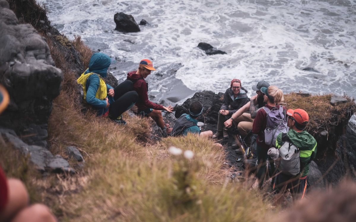
High tides force runners to wait it out on the Lost Coast.
Runners wait out the tide on the Lost Coast Day 1.

One runner scouted ahead for a possible bailout route that was loosely sketched out on a map, a creek and possible trail that climbed toward the hills. Meanwhile, the guide bounded between runners and ensured everyone knew the plan — or, more to the point, knew that there was a solid plan to begin with. 

Before long, they’d made the turnoff, climbed above the water and hunkered down next to now-infamous Buck Creek. That’s where the problem-solving really began. 

Sundown over the Pacific Ocean.

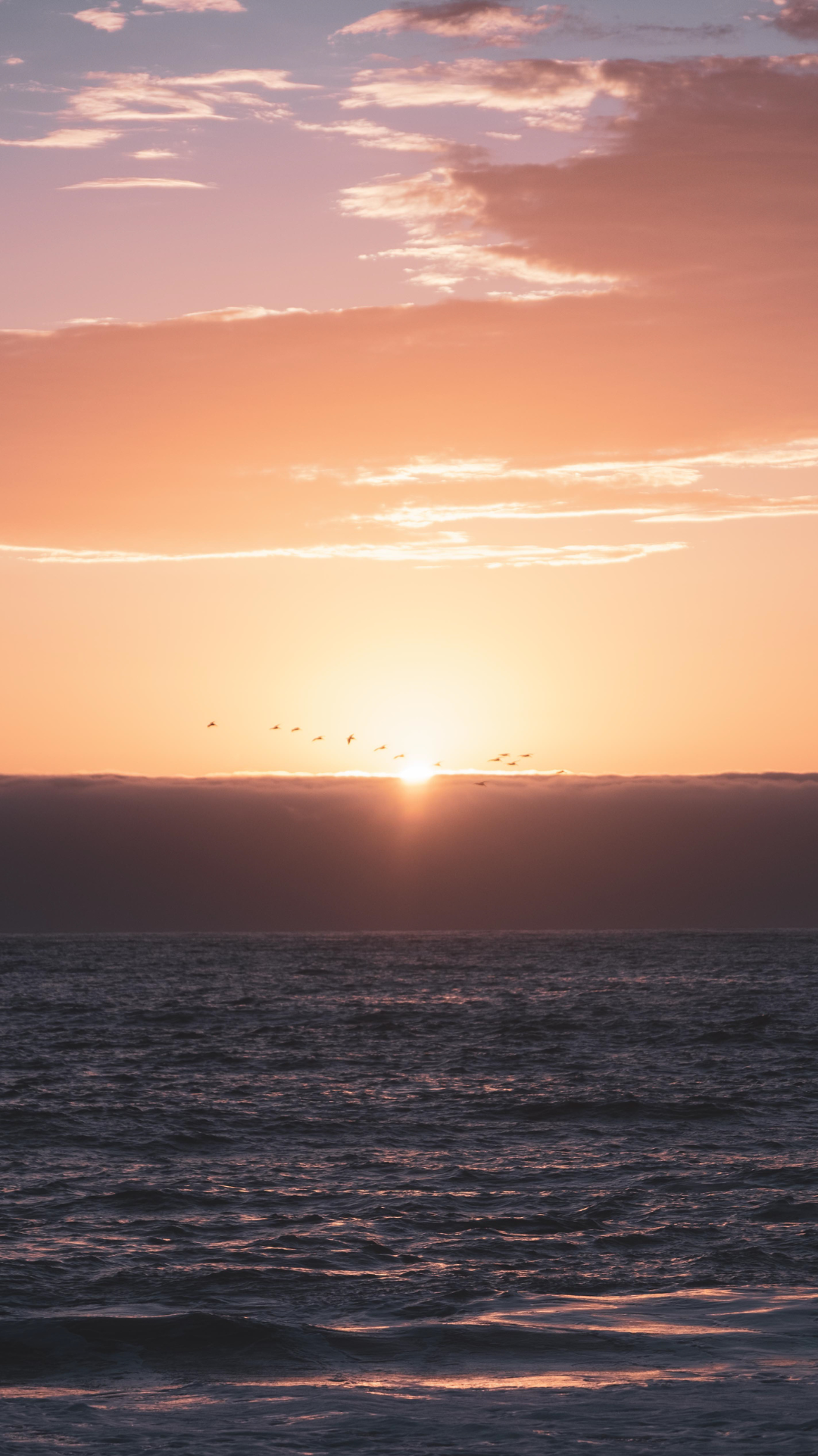
Realizing they would be out for at least twice as long as they had anticipated when they started running that morning, everyone emptied their running packs to share food. They inventoried supplies as it became clear they’d be bivvying on the bluff deep into the night. “What happens at Buck Creek stays at Buck Creek,” they’d say over and over, huddled in gold-colored emergency blankets as the sun dropped below the Pacific and turned the sky a stunning shade of orange. 

Unplanned and worrisome as it was at the time, it certainly could have been worse.

Aspire guides and many clients travel with Garmin inReach devices, which allow for some communication while in the field. By mid-afternoon on, the team shuttling camp toward Shelter Cove knew that nearly half the runners were taking an impromptu trek inland. So they made plans to meet runners who made the crossing in time and prepped backup plans for those who hadn’t. Even when things were uncertain and when communication became spotty, the situation never spiraled. It was one decision after another.

At one point that night, a guide loaded a van with food, water and beer and headed toward the beach group’s bail-out route in the event they abandoned the beach. The plan to meet them midway down the path was ultimately scrapped after the beach group decided to smartly wait out the tide and resume their beach trek at midnight. 

Alongside fresh bear prints, and with a renewed motivation to finish, the group pushed the pace and arrived at a twinkle-lit Sprinter van at 2 a.m. Hot food and beer awaited them, as did dry clothes, pitched tents and rolled-out sleeping pads back at camp. 


Situations like these are rare. They’re also where staying level-headed and thinking through decisions pays dividends, knowing that with proper risk management, it’s all-but-guaranteed everyone will stay safe and walk away with a story to tell. By breakfast some six hours later, the beach group was regaling everyone with stories of what happened, who stepped up and how well — all things considered — the night ended up going. Despite the lack of sleep, the beach group rallied and hit the trail for an abbreviated Day 2 trek. Everyone’s reward? Hammocks, lounge chairs, burgers and sunset over the Pacific, albeit this time from the comforts of a wooden camp bunkhouse alongside easy-going conversation and a bowl of dutch-oven-baked apple crisp. 

Aid station: Risk management in action.
Soaking in expansive Pacific Views at the aid station.

The first day set the tone for the rest of the trip, both in terms of things going wrong and finding solutions. Multiple runners’ water filters broke, so people worked together to share. On Day 3, when most of the beach group decided against making the 20-mile run/bushwhack to round out the trip, some pitched in on helping a guide navigate the harrowing narrow roads. Once everyone arrived at Usal Beach, the party at camp — complete with margaritas around the fire — lasted late into the night, up until a few raindrops began to fall… 

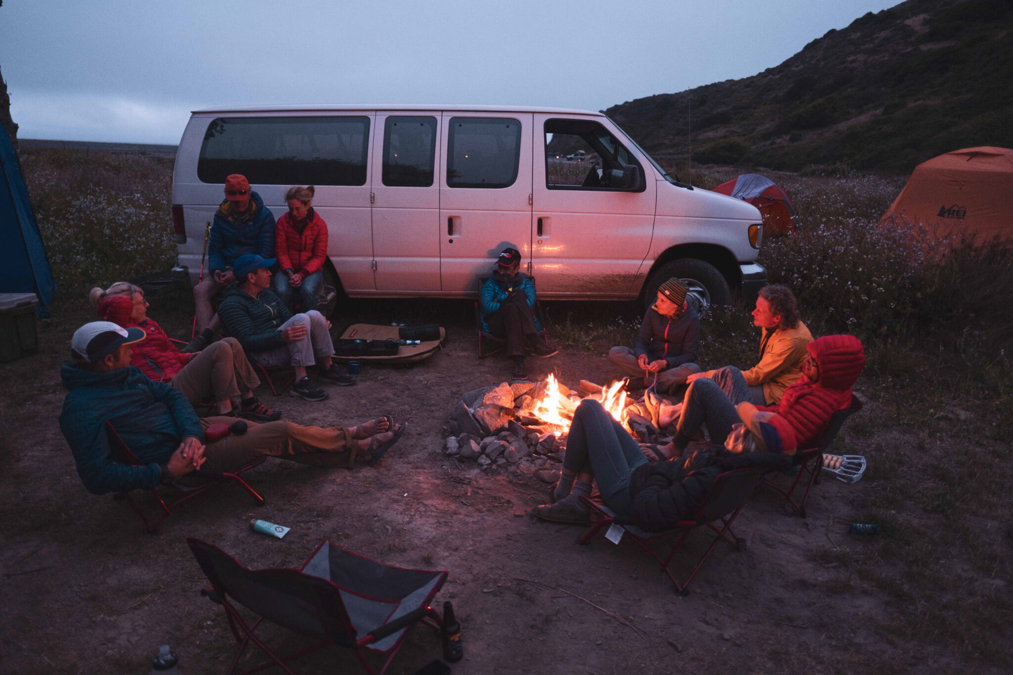
Image shows runners relaxing by the fire at Usal Beach.
Runners unwind by the fire after finishing the Lost Coast Trail Stage.

Raindrops turned to a downpour overnight. Bags and bodies were sopping wet by the time everyone piled into the vans to leave that final morning. But the rain had turned the campsite to tacky soup that swallowed Aspire’s loaded Sprinter van tire. 

For a moment, anxiety swept the group. Some people had flights to catch later that morning. Most everyone had “real lives” to return to. But the van went nowhere, even with a dozen runners attempting to shove the van forward. So much for Plan A. 

Plan B: Surely one of the 4×4 crews camped a half-mile away at the beach had some traction skids they could loan out. But one by one, the gruff beach campers told a guide that they didn’t have skids and hadn’t seen anybody with them, either. Despair deepened. 

On to Plan C: Build an improvised skid, replete with rocks that both guides and clients had scooped up from camp and smashed together into an improvised backcountry traction device. Some looked on skeptically. Others made the kind of nervous laugh someone makes when they know something will make a hilarious story someday when they’re dry and not off the grid hanging around camp in a downpour with a stuck van. 

One more hope-filled push from everyone and the Sprinter lurched forward and fishtailed through camp toward the hard-packed road. 

Cheers. Claps. Problem solved. 

Then gasps. 


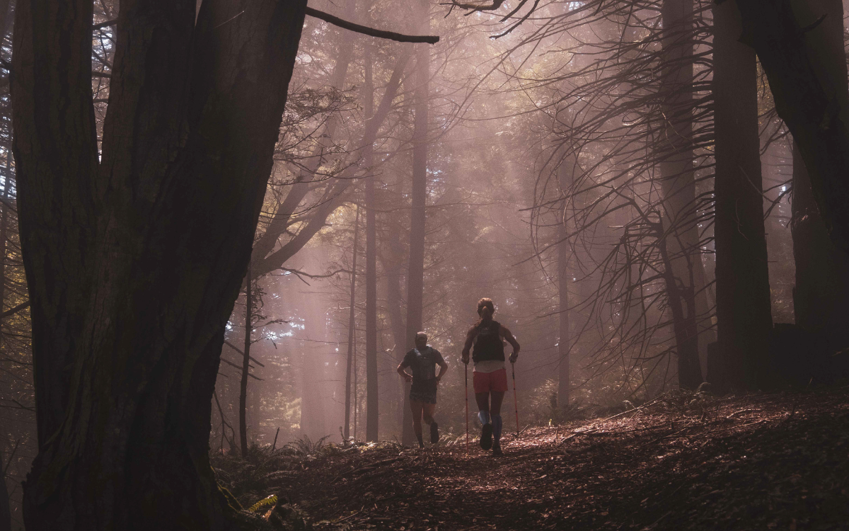
Images shows the misty forests of the Lost Coast.
Running through dappled sunlight in the eucalyptus groves.

Exactly what happened before the Sprinter made it to that road will make for a helluva story on problem solving, that is, after the body shop gets a look at the dented side and damaged door, courtesy of a leaning tree.

At the Leggett mercantile where a group of strangers had met several days earlier, now everyone high-fived, hugged and swapped phone numbers after an unforgettable trip on the Lost Coast. 

The views and stories will no doubt outlive any “I survived” hat. 

There is talk, though, of making a t-shirt about what happened up Buck Creek…


Run the Lost Coast Trail Stage with Aspire.
2023 Registration opens November 1st, 2022.


Jason Pohl, 32, raced road marathons for a decade while also bagging peaks in Colorado’s high country and taking backpacking trips throughout the West. He ran the Boston Marathon twice and in 2012, largely on a whim, did a self-supported bicycle tour from Washington to Maine. He’s now all-in on trail running with a handful of 100k finishes in the books and a string of self-supported adventures on the horizon. He works in the “real world” as an investigative journalist in Sacramento, California, where he lives with his partner, Mel.

Categories
art Art Aspire Culture Assorted Blog courses Culture Highlights NRL Rendezvous Runner Resources trip report Trip Reports and Trip Styles Trip Styles

Mountain Songs and Alpine Legs

Music and mountains. Both have an incredible ability to create real connections.
Aspire Rendezvous trips are mountain running parties where runners develop a relationship with an incredible wilderness zone and the other runners they’re with. Incredible days on trail are bookended by a vibrant basecamp scene that may include music, yoga, swimming and more. Musician David Burchfield shares his experience as camp musician for 2022’s Nooksack Ridgelines Rendezvous for the journal.

Listen to David’s album “State to State” while you read!


My first day of the Nooksack Ridgelines Rendezvous I found myself deep in flow, rolling down Ptarmigan Ridge near Mt. Baker. Some smoke from nearby fires had drifted through that morning but was clearing up as the day went on – dramatically unveiling luscious green forests, stark peaks, and alpine lakes in true North Cascades glory.

I’d started out with another runner, Melissa, but she had cruised ahead while I drifted back until I was between groups. I was just far enough from other runners that I felt safe belting, I mean absolutely shouting, along with the song I’d been jamming to in my earbuds. It had been a pretty tough year for me, full of huge personal disappointments that left me feeling gridlocked inside. There was a twisted knot in my chest of regret and a bleak, uncertain feeling about where and when I might ever find deep joy again. In that moment, I was surprised and delighted to find the freedom to unlock my heart, open up my lungs, and move my legs over some really beautiful terrain was just what I was needing. I found myself supported, once again, by two of my oldest friends: the mountains and music. 

Kulshan (Mt. Baker) from the Ptarmigan Ridge Trail.

Making the final descent to the waiting Aspire van (complete with cold beers and watermelon) I put on an album I’d been saving all year for just this opportunity, although I didn’t know it until then. Hiss Golden Messenger’s “Quietly Blowing It,” inspired by the artist’s own feelings of internal lockdown and finding release and freedom  in the midst of pandemic, was the perfect balance between hopeful beats and sober lyrics. I danced down the forest trail, capering sideways, high stepping short steps, and playing with fun flowy arms – and a huge smile came across my face. I have always felt a strong connection between breath, running cadence, and rhythm in the music that I listen to while out on longer days, but this particular run was special. I let go and let the mountain music flow through my legs.

A nutritious bowl – Aspire fare.

Back in camp, while Aspire guides doled out super tasty appetizers, runners dipped their legs in the rejuvenating water of the Nooksack River as part of their recovery rituals. Nearing dinner, folks began to gather and prepare for the feast – sharing stories of the day. At some point, Kim said “Were you… singing up there?” A short pause followed as looks of recognition dawned on the faces of Kim’s running companions of that day and my own. We burst out laughing as we realized that my solo karaoke session was anything but private. Luckily, I love singing mountain music for other people and later did exactly that with my guitar around the campfire while runners relaxed and stretched. Playing mountain music for the group was, in fact, what brought me onto the trip in the first place. 

Musician David Burchfield sings sounds to runners on the North Cascades Rendezvous.
David Burchfield play guitar to the runners at the Nooksack Ridgelines Rendezvous.

Because the rendezvous experience is all about gathering at a central location each evening, there’s a uniquely relaxed and communal spirit to the post-run hang in camp. The crew often brings along a musician or two to provide some evening entertainment and that night I was lucky enough to play the bard. After the first night, I took requests from other runners and prepared them for the next evening’s “performance.” Performance? More like, singalong, arms around the shoulders, smores and beers kind of hang out. You may think I’m exaggerating, but I promise I am not – it’s that kind of picturesque good time. 

Mineral Mountain in the North Cascades
A view of Mineral Mountain from Copper Ridge, North Cascades National Park.

Over the course of our three days out there, the members of my trip went from perfect strangers to new friends – forming small groups to run together and encourage each other through long, beautiful days in the mountains. By day three, we left from the trailhead practically all together in one supergroup. I’d made friends, played some mountain music, found refreshment in my spirit, and learned just how far I can really run. Day three found me without headphones at all – instead I spent most of the day chatting in the little running groups that I found myself in, or pushing my pace to catch the next group of friends ahead of me. You can be sure that between groups I will still belting out a tune or two.

Fields of wildflowers in North Cascades National Park.

All photos by Jessica Vandenbush.


Join us for four days of incredible running and camping on the Nooksack Ridgelines Rendezvous!


David Burchfield is an adventurer, trail runner, and touring musician based for now out of Salt Lake City, Utah.

Categories
Aspire Culture Blog courses Destinations Highlights River of No Return Stage RNR Stage Trip Reports and Trip Styles Trip Styles

The River of No Return

Do you want to run through the deepest wilderness in the lower 48? Float one of the continent’s most remote and wild rivers? Encounter the tracks of wolverines and Bighorn sheep? Run through deep forest and steep, rugged mountains? Soak in hot springs? Explore ancient indigenous caves and pictographs? Swim in the cleanest water you’ll ever experience? Cast flies in one of the healthiest trout fisheries on the planet? How does it sound to do all this away from any motorized vehicles or roads for five days?

New Terrain to Run

Running and floating along the Middle Fork of the Salmon is truly a once-in-a-lifetime experience. This year Aspire Adventure Running -in collaboration with Helfrich River Outfitters- is excited to introduce a one-of-a-kind running/rafting wilderness trip.

Over five days, run up to 80 miles along the river (~20 miles each day) and then float the final 40, or you can float as many days as you want. You can bring family or friends who can float while you run. And every night, you can gather up around the campfire to trade stories and scouting reports from your adventures in this deep, beautiful, one-of-a-kind wilderness.  

A Wild and Scenic River

Known as “The Best River in the World,” The Middle Fork of the Salmon flows 104 miles through the deep heart of the Frank Church River of No Return Wilderness. It has over 350-nearly continuous- rapids between class I-IV.  The Salmon gained its name, the “River of No Return,” when early twentieth-century wooden boats could navigate downriver, but not get back up through the powerful rapids. Unlike the Main Stem of the Salmon River, the Middle Fork has no motorized jet boats, so you are in true, remote wilderness.  Outside of Alaska, there is nowhere more remote in the United States.

The Salmon River canyon is even deeper than Arizona’s Grand Canyon, but unlike the Grand Canyon’s towering cliffs, the Salmon River Canyon is a diverse combination of wooded ridges, huge bluffs and slides, solitary crags and stone towers.  It’s a classic northern Rockies landscape of Douglas Fir and Lodgepole pine beneath steep scree and rock slopes.  This is the ancestral land of the Tuka Deka Sheepeaters tribes and the Shoshone and Nez Perce. Their artifacts and pictographs are spread throughout the landscape, along with the remnants of a handful of old mining and pioneer cabins.

History of Wilderness

Designated in 1980 and including a mixture of National Forest and BLM land, The Frank Church-River of No Return Wilderness is the largest contiguous wilderness in the lower 48 with 2.367 million acres. Together with the Gospel Hump Wilderness and connected roadless Forest Service land, it is the core of a 3.3 million acre roadless area. Nearby, separated only by a single dirt road, the Selway-Bitterroot Wilderness adds over a million more acres to this massive area of wild, conserved land tucked up in northern Idaho.

The Wilderness is named for US Senator Frank Church, a Senate floor sponsor of the 1964 Wilderness Act (which protected 9 million acres of US land) and the Wild and Scenic Rivers Act, which included the Middle Fork of the Salmon. Indeed, Church-who also helped to create the Hells Canyon Recreational Area and the Selway-Bitterroot Wilderness- was, along with luminaries like Mardie Murie, Stewart Udall and Howard Zahniser, one of the pivotal players in the mid-century US conservation movement that became a model for the rest of the world.

Because of its size and remoteness, this region provides habitat for wolverines, mountain lions, gray wolves, black bears, lynx, coyote, bighorn sheep, mountain goats, elk and moose. While there are no established populations of Grizzlies here, there probably will be in the future because the habitat is perfect for them. As you run and float, you’re sure to see wildlife, and lots of sign.

Crown Jewel of American Conservation

As an old rafting guide myself, I can tell you that the Middle Fork of the Salmon is one the handful of premier river trips on the continent, a dynamic mixture of great whitewater, remote wilderness, and beautiful landscapes.  I can also tell you that there are few experiences more privileged than a wilderness float trip, where you can be a remote area, but with coolers of food, dutch ovens, and all of the other things you can’t bring on a backpacking trip.  To combine such an opportunity with trail running is truly special.

Frank Church once wrote that, “The great purpose is to set aside a reasonable part of the vanishing wilderness, to make certain that generations of Americans yet unborn will know what it is to experience life on undeveloped, unoccupied land in the same form and character as the Creator fashioned it. It is a great spiritual experience. I never knew a man who took a bedroll into an Idaho mountainside and slept there under a star-studded summer sky who felt self-important that next morning.”

So, come experience one of the crown jewels of American conservation, one of the great wildernesses and remote rivers. Run. Float. Cast. Soak. Put a bedroll down on an Idaho mountainside with us. You’ll be glad you did.

Run/Raft the River of No Return Stage Trip

A Raft Supported Multi-day Run on Idaho’s Famed Middle Fork of the Salmon River

4 Run Days, 5 Raft Days, 80 Miles


About the author:
With three decades spent exploring the PNW and Alaska, Ian Ramsey is based in Maine, where he directs the Kauffmann Program for Environmental Writing and Wilderness Exploration, and teaches writing, ecology, brain science, music and mindfulness to high school students. With over two decades leading trips and expeditions across the US, Alaska and internationally, he loves empowering people to take agency in their lives and discover new places. Ian is a poet and graduate of the Rainier Writing Workshop, and his writing has been featured in places like Terrain.org, Orion and High Desert Journal.  He also directs a community steelband, loves kayaking big water, drinks copious amounts of coffee, geeks out around nutrition, literature and fitness, and was once a member of an Inuit Dance Troupe.


Categories
Affinity Trips Aspire Culture Destinations Highlights Runner Profile Runner Resources trip report Trip Reports and Trip Styles Trip Styles update WL

Seeing Possibilities on the Wonderland Trail

Last year, Aspire received a call from @teamseepossibilities about doing a custom trip around the Wonderland Trail for blind runner Dan Berlin and his guides. Their team goes on epic endurance challenges never done by a blind athlete, inspiring individuals, with or without disabilities, to go beyond perceived limitations.

Fast forward this month, when Dan and his team of guides faced the challenges of the Wonderland Trail head on. This is their trip report.


In the early morning of August 2, 2021, we strapped on running packs and set out on the Wonderland Trail. With over 23,810 feet of elevation gain and 5 major river crossings, the Wonderland Trail is a series of long, rugged ascents and descents around the circumference of Mt. Rainier just below the glacier line. 

 The goal: Complete this grueling, 93-mile trek in 3 days.   

The inspiration: If successful, Dan would become the first known blind athlete to complete this extreme endurance challenge. We hoped to inspire people with disabilities to set ambitious personal and professional goals. We were also raising money for Team See Possibilities Global Scholarship fund, which supports students with vision impairment with financial scholarships, peer-to-peer support, and monthly mentorship by Dan and other successful blind professionals.

The problem: In addition to the obvious physical challenge of trekking the circumference of Mt. Rainier, the narrow, often rock-strewn trail presents particular problems to a person who is blind. Even with Brad and Charles calling them out, Dan often tripped on protruding roots. His ankles rolled uncomfortably on the uneven terrain with the ever-present threat of a major sprain. The many loose volcanic rocks gave him a strange sensation of vertigo from their constant shifting movement under his feet. Overhanging tree branches and foliage hitting his face disoriented him. And drop-offs along the trail presented an ever-present risk – often, one of Dan’s guides nudged him to safety just before he took one wrong step into a serious fall. Brad and Charles found it exhausting to stay ever alert, and realized the techniques that had worked on previous adventures were falling short.  To stay safe, we had to move cautiously. As a result, the first 34-mile section of the trail took over 21 hours to complete. Arriving around 4 a.m. at the Mowich Lake campground, we discussed our options and decided that the combined physical demands and mental strain made the risk of injury too great to continue. A kind volunteer from Aspire Adventure Running drove us out of the wilderness.  It’s always disappointing when you fail to accomplish a goal, but sometimes the most disciplined option is to stop. And if you never fail, you are certainly not setting your goals high enough. We were gathering data throughout those 34 miles, and realized it wasn’t prudent to continue. As a result, the Wonderland Trail Challenge became 21 hours traversing 34 rugged miles and climbing 10,000 feet on a stunning mountain.   

Taking on endurance challenges like the Wonderland Trail is analogous to the experiences of the Team See Possibilities Scholars we support. A student who is blind going to college for the first time is both excited and intimidated. There are few role models to follow, few peers to connect with. You must learn to ask for help and work as a team. Your resourcefulness and ability to adapt are tested constantly. You are unsure of the outcome, but you proceed anyway. Sometimes things go as hoped. When they don’t, you learn from the experience, then set your next ambitious goal.   A great way to go through life is to do physically challenging things in nature with people you like, and link it to a meaningful cause. And that’s exactly what we’re going to continue doing. Team See Possibilities will take on more endurance challenges. We’ll continue to provide scholarships to students with vision impairment. And we challenge everyone we meet with this simple piece of advice: go beyond your perceived limits.


​Team See Possibilities inspires and empowers young people with vision loss to thrive and excel. Learn more about their mission and vision at www.teamseepossibilities.com.

If you can dream it, we can crew it. Learn more about Aspire custom trips.

Categories
Blog courses Destinations Highlights Skills Sucia Island WFA SUCIAWFA Trip Reports Trip Reports and Trip Styles Trip Styles update

Sucia Island Wilderness First Aid: Trip Report

by Maryanna Brown

Our Sucia Island Wilderness First Aid course is a collaboration with instruction from Backcountry Medical Guides and the Aspire basecamp experience, creating an idyllic classroom where trail runners recieve sport-specific instruction on how to prepare for and respond to adverse events in the wilderness. Participant Maryanna Brown shares more in the following trip report.


Gearing up for a summer of mountain adventures, I knew it was time to refresh my rapidly deteriorating first aid skills.  I took a Wilderness First Responder course several years ago, but I hadn’t had to use any of the skills (thank goodness) and was feeling decidedly iffy about my abilities to respond to an emergency in the backcountry. If I packed a first aid kit at all, it was either mini pre-packed baggie of mystery items I wasn’t really sure what to do with or a behemoth first aid kit overflowing with dusty gauzes, ointments, a selection of picked over bandaids.  A Wilderness First Aid course geared towards trail runners seemed like just the ticket to kick off a summer of backcountry adventures. Not only would I feel more confident about going further into the backcountry solo, but I’d be a better partner for my trail running buds.

I had never heard of Sucia Island before the course and had no idea what to expect when the ferry pulled up to Orcas Island on Friday afternoon.  From the ferry terminal, we took a quick shuttle van ride to catch our chartered boat to the mysterious Sucia Island.  Speeding through splashing white-capped waves with dolphins breaching in the distance was sheer delight.  It truly felt like we were leaving the rest of the world behind, charting a bold new path to trails that weren’t even listed on Trail Run Project.  

Sucia Island did not disappoint.  It was a little slice of wooded paradise with enviable sunsets and zero cars.  It’s only accessible by small boats and it’s criss-crossed with a spider web of dreamy single-track with peek-a-boo glimpses of Kulshan (Mt. Baker) and the Olympic Mountains.   We had our own secluded group campsite which had the effect of making us think we were the only ones on the island.  Not until we started exploring Sucia on our morning runs, did I realize the island was a buzz of kayakers, sailers, and the happiest dogs I’ve ever seen.   I think almost everyone there remarked at least once that they would prefer to say goodbye to life outside the island and settle in for an extended stay of sunsets, otter parties, and lonely trail runs. 


We may have been on “island time” but we had a bit of routine to our days.  The early birds would start the day with 6:30AM exploratory runs around the island,  skipping down the little land fingers that jutted out into the sound and marveling at the blossoming succulents and seals bobbing just offshore. We’d roll back just in time for freshly brewed coffee (!!!) and a delicious homemade breakfast.  I’m vegan and Aspire did an amazing job providing plant-based alternatives that were just as tasty as they were nutritious – tofu pad Thai, ridiculously good potato breakfast burritos, and high protein snacks like edamame pods. We’d even have happy hour with cold beers, cider, and hard seltzer and appetizers while waiting for dinner every night.  Now I finally understand what glamping is. I like it.  

Backcountry Medical Guides ran such an engaging and fun course.  After breakfast, we’d have class on the beach (!!!) and while it was somewhat distracting to have a family of otters playing in the background, it was pretty amazing.  The course was a perfect mix of hands-on scenarios and mini-lectures.  

We started with the ever important patient assessment system – concrete steps to take when faced with any incident in the backcountry.  From there, I learned a ton of steps to take when faced with various trauma, medical, and environmental emergencies – with a particular focus on emergencies most commonly faced by trail runners such as rolled ankles, heat exhaustion, and wound care.   One of the highlights of the course was performing chest compressions on a mannequin while one of our instructors blasted Whitney Houston’s – I Want to Dance with Somebody, to keep the beat.  Hilarious, yet surprisingly helpful.  With the soaring temperatures in Seattle this week, I’ve already used what I learned about heat emergencies and their prevention to not only keep myself safe but monitor those around me. 

One of the most helpful lessons was on first aid kits and ways to keep the weight pared down by picking items that can have multiple uses.  Apparently honey can be used as an antibiotic, source of sugar for a diabetic emergency, and a tasty addition to a peanut-butter sandwich.  

I not only traveled back from Sucia with a keen interest in perfecting my first aid kit (add honey) but some new friends!   Some of the Seattle runners exchanged numbers at the conclusion of the course (Sunday) and by Tuesday morning, I was out for a dawn patrol lap around Green Lake with another woman from the course with plans to regroup at the Big Foot 20 miler in early July with a few more students.   All in all, I couldn’t have asked for a better Wilderness First Aid course experience. The Sucia Island WFA was a perfect blend of education, glamping, trail running, and hanging out and swapping stories with other runners.   


The Fall Edition of the Sucia Island Wilderness First Aid Course takes place August 27th – 29th. Learn more and register!

Categories
Aspire Culture Blog courses Destinations Highlights SUCIA Sucia Island WFA Sucia Island: Rendezvous SUCIAWFA Trip Reports and Trip Styles Trip Styles

Geology of Sucia Island:

Folds, Faults, Tafoni, a Ghost Forest, and a Dinosaur!

What a lot of variety packed into less than a square mile of rock!  Sucia Island has many features that delight anyone interested in the natural environment.  For runners and hikers, an extensive network of trails leads the curious to all of these features. Also, at low tide much detail can be seen by walking (safely!) portions of the shoreline. Let’s briefly describe some of the most noteworthy geologic features.

The Rock

Except for the bedrock ridge making up the southwest portion of the island, bedrock here is made of sedimentary rock named the Chuckanut Formation for similar rock found on Chuckanut Mountain near Bellingham.  The rock is mostly sandstone but in places siltstone and conglomerate are interlayered, telling a story of an ancient meandering river system existing about 50 million years ago that deposited sand, silt, and pebbles.  Plant fossils are abundant, including fossilized wood, and sparse evidence of terrestrial animals has been found, mostly tracks.  The fossil assemblage suggests a humid subtropical climate during the time of deposition, quite different than today’s  local climate.

Fossil Bay was the site of quarrying of sandstone over a century ago. The massive blocks were barged to Seattle for paving stone. You can see the remains of the quarry near the dock in Fossil Bay.

The oldest bedrock on Sucia is the Nanaimo Group,  making up Little Sucia Island, the ridge south of Fox Cove and along the south shore of Fossil Bay. Siltstone is the dominant rock type and it contains abundant fossils of invertebrate marine organisms such as clams, snails, and ammonites.  At low tide you can easily walk along the marine terrace , a product of  wave erosion, until a cliffed shoreline blocks progress.  The rock  on the high cliff is completely unsuitable for climbing, being finely fractured, soft, and unstable.  

The Nanaimo rocks are at least 75 million years old and evidence indicates they were transported as much as 1000 miles from their depositonal origin by plate tectonics.  How?  Glad you asked! The evidence is complex but centers on the latitude of formation of rock of similar age on the mainland dated by paleomagnetism.

The surface of the entire island shows clear evidence of being overridden by glaciers. Rocks include abundant  light-colored granite pebbles, cobbles, and boulders,  as well as various other rocks such as quartzite and greenstone not local to the San Juan Islands. These rocks originated in the mainland of British Columbia where they are found as bedrock. Transported by moving glaciers, the rocks were dumped when the ice melted here about 10-12,000 years ago. Maximum elevation of similar boulders on the mainland indicates that at maximum continental glaciers in the area of the  present-day Salish Sea were over one mile thick! 

The Fault

If you walk along the north shore of Fox Cove at low tide, you might notice the light gray rock making up the low backshore cliff just above high tide level. Look closely and you might see some “S” shaped folds in the bedrock. This is evidence of the Fox Cove fault, which brings into contact the 50 million year old Chuckanut Formation with the 75 million year old Nanaimo Group. The actual contact is not exposed, but the younger rock sliding over the older Nanaimo deformed  the rock near the fault contact zone into these folds.


Plunging Syncline

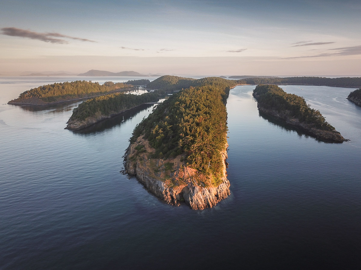
Glancing at a map you’ll see that Sucia Island is shaped like a  horseshoe  that is seeking  to be hooked on an imaginary post somewhere to the southeast. What’s going on here with this unusually shaped island?

The parallel ridges, elongated smaller islands, and intervening valleys and embayments are all part of a structure called a syncline. At the same time that the Fox Cove fault was breaking rock, the sedimentary rock layers of the Chuckanut Formation were being deformed when they were beneath Earth’s surface. Synclines form ‘troughs’ where bent layers are inclined (dipping) toward a centerline, which in this case is plunging (passively ‘diving’) toward the southeast.  The ridges are more resistant rock (sandstone) and the lower ‘valleys’ between are the less resistant rock (siltstone).

Tafoni and Honeycomb Weathering

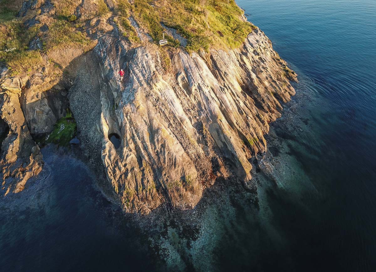
Many places along the island’s shoreline show a “honeycomb” structure in bedrock, and along the  central shore of Shallow Bay there are large (washtub to bathtub size) cave-like cavities. The later are tafoni (Italian)and are weathering features.  To develop they require permeable rock, salt, and repeated cycles of wetting and drying. When saltwater splashed  on the rock dries , tiny salt crystals form and  wedge the sand grains apart. The sides of cavities are more shaded and are damper, inhibiting crystal formation, so the rear of a cavity deepens with time. Multiple cavities can overlap and produce bigger cavities.  Large tafoni in  the central east shore of Shallow Bay are often called the China Caves and allegedly were involved in smuggling operations long ago.

The Dinosaur!

In 2014 a fossilized bone was found in the Nanaimo rocks near Ev Henry Point at the southeast end of Fossil Bay. This was identified as a part of the left femur of a theropod dinosaur, the same category of reptile that includes T-rex and velociraptors.

This is the first and only dinosaur fossil yet found in Washington! Clam shell fossils found within the hollow part of the bone prove that the skeletal remains of a land-dwelling dinosaur washed into the ocean.

“Ghost Forest”

Just inland near the south shore of Shallow Bay you will notice a number of standing dead cedar trees…a “ghost forest.” What caused the trees in this grove to die?

Hypotheses included 1) an earthquake causing subsidence and subsequent flooding, and 2) flooding from either a tsunami or large storm waves led to salt water intrusion that killed the trees. 

But recent (2008) information tells the real story. Early homesteaders blocked the natural outlet of the small stream in the area because they desired a reliable source of surface fresh water in the pond they created. The flooding killed the trees….. less dramatic but true.


While on Sucia, be sure to read the information on the kiosk up the path near Fossil Bay dock. It contains much of the preceding information including pictures. The geology panel was prepared by George Mustoe,  a former classmate  of this writer and a noted authority on both Sucia Island and Chuckanut Formation geology.

An important note is that it is illegal to collect natural materials in state parks, including rocks, fossils, and plants. Take only pictures and memories, leave only footprints!


Prepared by Doug McKeever
Geology professor (emeritus), Whatcom Community College, Bellingham

Join us for the Sucia Island Beach Camp and Trail Running Extravaganza! June 4th-6th, 2021
Categories
Blog courses Destinations Highlights NCT North Cascades Traverse Stage Preparation Runner Resources Stage trip report Trip Reports and Trip Styles Trip Styles update

Crossing the North Cascades: A Trip Report

“If you were to tell me that getting stung multiple times by bees in the backcountry (FYI i’m severely allergic) and finishing our second day in the dead of night, exhausted after 16+ hours on the trail, would somehow be my personal ‘highlight’ of the entire trip crossing the North Cascades, I would have called you crazy.“

Soaking in the North Cascades

The North Cascades Traverse is an epic three day stage run covering 80 miles of pristine wilderness in the beginning of autumn, crossing the North Cascades via less travelled trails through the rugged mountain range sometimes referred to as the “American Alps”. After closing off an unreal Wonderland season and spending back to back weekends on such magical trails, I was excited and curious to step into totally new territory! 

Day 1: Highway 20 to Colonial Creek via Easy Pass

We met our small but mighty crew bright and early for our shuttle start and headed out mid-morning to climb up Easy Pass. Runners were stoked on crossing the North Cascades. The first few hours up to Easy Pass flew by. We laughed while taking in the big views into Fisher Basin from the pass, knowing the remaining 20 miles was essentially a gradual downhill grade. Once reaching camp, I took a moment to quickly dip into the icy waters at Diablo Lake before the last patch of sun was lost behind the towering mountains.  After a quick refresh and icy jolt to the muscles, I headed back to camp to cheer on our other runners coming in. It was time to relax around the fire with a big meal.

Day 2: Ross Lake Dam to Graybeal Backcountry Camp

Crossing the Ross Lake Dam with Doug McKeever

Waking early the next morning, my job for the day was as the ‘sweep’ guide, hanging back with the last runner. With 33 big miles ahead of us, I was ready to hit the trails with 72 year old Doug Mckeever (a bit of a local ultra running legend in the North Cascades). I got to know Doug briefly the day before, and having been informed by others of his endless stories and knowledge of the Cascades, I was thrilled to a have a big day out together.

As we crossed Ross Dam towards Big Beaver Creek that morning, it was evident we were in for a solid day out together. We dove right into sharing epic adventure stories, talking in great depth of our favorite trail snacks, laughing at the sluggish pace in which Doug would eat said trail snack, foraging for berries along the route, and listening to him reminisce on memories from before I was even born on the exact trails we were running on now.

A mountain buzz

Day two crossing the North Cascades was going great, but that quickly turned when a group of three hikers came forward, warning us of a very angry swarm of bees 2-3 miles ahead. One of the hikers was stung 11 times and the others were also bit multiple times.  Knowing Doug was allergic to bees and keeping in mind my own personal experience breaking out in full body hives from the last time I was stung, we continued forward apprehensively.  

We ran forward checking our watches as we neared the 3 mile point, unsure of what to expect. Reaching 3.3 miles, we began loosening up, believing we had hit a stroke of luck and passed the hive. As soon as we convinced ourselves we were ‘in the clear’, the raging bees emerged from their domain ready to attack.  We lunged forward in a full sprint, evacuating the area completely.  Doug and I were both stung multiple times and quickly retrieved our ‘miracle drug’, Benadryl, out of our med-kit.  Knowing this would concurrently be our saving grace and make us feel drowsy and light, we continued on for the remaining 18 miles.  

What happened from that point on until reaching the base of the climb up to Whatcom Pass, was a blur of ridiculous jokes, tons of snacks and berry foraging to keep our energy high, along with one or two deep internal desires for a short nap on the trail.  Our energy low as night began to creep in, we began the endless climb up to the pass covering more switchbacks than one would hope so late into the night. 

As we carried on surrounded by darkness, headlamps lighting the way, we knew we were making progress. We both genuinely felt this sense of calm and enjoyment being out there together so late at night.  After endless switchbacks, we hit the peak of our climb. We were unable to see so much of the ‘epic views’ we were told about, but  that didn’t bring our spirits down.  We continued on, repeating Doug’s famous phrase, “I always have more to give”.  Besides, while everyone was already at camp, we were at the top of the pass feasting on more blueberries than we had cumulatively consumed all day – enjoying some of the freshest hors d’oeuvres to our soon-to-be late night dinner! 

After making our way down towards our backcountry camp at Graybeal, we noticed a few small, glimmering headlamps in the distance.  Hooting and hollering as we made our way towards the group, we quickly realized most people were fast asleep after their own big day out. Full of exhaustion and ravenous for a big meal, Doug and I peeled off our sweaty clothes and bundled up in warm layer as Abe fired up the stove.

We sat down and shovelled the steamy, salty, caloric goodness into our mouths. The duality of pure exhaustion and a surge of energy struch while recounting all of our personal shared adventures on the trail for the day.  Abe mentioned how astounded he was to see our spirits so high after nearly 17 hours on the trails.  I looked up at Doug, and huge smiles broke across our faces. We finished the last of our dinner before heading straight for our sleeping bags for a peaceful night in the open air, under the stars.  

Camp vibes: food, drink and good conversation.

Day 3: Copper Ridge

The unrivaled views from Copper Ridge

We all woke early the following morning, with one last big day in the mountains ahead. I ran ahead of our group to reach our final basecamp early and ensure the food, drinks and a welcoming celebratory camp was ready for everyone as they finished! 

As I ran ahead thinking I would be solo for much of the day, our photographer Nick caught up in the first few miles and said he’d be joining me up until we reached Copper Ridge. I was elated to have his company, and we ran on, excited for the day ahead. As we started our ascent to the ridge, we were speaking of our epic prior trail days with Doug. 45+ years our senior, he had previously anointed both of us his ‘honorary grandchildren’. Our spirits were high before even reaching the highlight of the day – Copper Ridge.  Opening up out of the trees after a big climb, we were gifted with sweeping views across the Cascades that extended for miles.  

We stopped for a quick snack together at the lookout point, both full of energy and buzzing from the surrounding landscapes. I then carried on to basecamp. Nick stayed behind to capture photos of our Aspire runners as they came up the ridge, all just as mesmerized by the views as we felt.

I continued to revel in the wild landscapes while my mind kept going back to all the moments of true connection I felt on the trail in only a couple of days.  I crossed over Hannegan Pass and ran down into the Ruth Creek drainage to meet the remaining Aspire Crew. Always full of trailstoke and personal stories of our day, we worked together to prepare and set up our celebratory camp for all the runners as they finished crossing the North Cascades.

After having spent the latter part of my day running solo, I couldn’t wait to see everyone run in, all full of exhaustion, admiration for the landscapes, and a healthy level of pride in what they had just accomplished both individually and as a collective.  

Cheering for Doug as he ran in felt especially significant after sharing such genuine moments out on the trail with him the day prior. I was also elated to have his beautiful wife (of 50 years) Audrey be there to cheer him to the finish as well. 

Seeing everyone come in, sharing stories, scarfing down food and with a buzzing level of contentment, I felt an immense wave of gratitude. At that moment I felt that no matter what happens out on the trail, whether it’s being fully enamored by the wild landscapes, swapping stories, or even something as ridiculous as being attacked by an angry swarm of bees — when they are shared in the company of others, you are setting yourself up for a truly epic adventure.  

Join Aspire on a North Cascades Traverse trip and enjoy the sweeping views and rugged valleys of the “American Alps”. Terrain this good shouldn’t be this runnable, and yet…!


Kara Folkerts is a plant powered trail runner, sustainable travel advocate, yoga teacher, and passionate about all things sustainability, travel, health, and outdoor movement.  Originally from Canada, Kara has spent the last few years exploring and living abroad in various countries across the globe before joining the Aspire crew in 2020. Kara has been guiding various trail running, sustainability, and health retreats internationally since completing her undergrad in Ecotourism and Outdoor Leadership.  With all of these experiences, she seeks meaningful connections with others, loves to learn of new cultures, and fosters the mindset of a lifelong learner.  With a big heart for trail running and exploring wild places, she’s always stoked to get out there with others. 

She writes about all her adventures on her blog at www.karafolkerts.com and on her instagram @karafolkerts

Categories
Blog courses CYPRESS Cypress Island Rendezvous Destinations Highlights Preparation Rendezvous Runner Resources trip report Trip Reports and Trip Styles Trip Styles update

Cypress Island Trip Report

Joining Aspire for our Cypress Island trip in the San Juan archipelago combines ‘choose your own adventure’ style running with relaxation, incredible ocean views, delicious home-cooked meals and beach camping with late night bonfires.

Adding the Cypress Island trip onto our roster of trips opened up an opportunity for folks to enjoy a different landscape at their own pace. The island has over 20 miles of volunteer-maintained trails and 3,800 acres of designated Natural Resource Conservation Area managed by the Department of Natural Resources. These beautiful trails and natural spaces see much less traffic than other neighboring islands.  

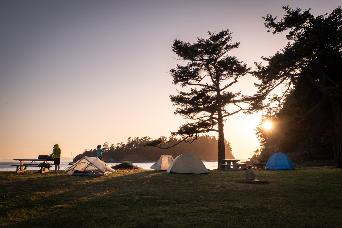
Coming in by charter boat on Friday evening, we set up base camp along Pelican Beach as we settle into the weekend.  After devouring a delicious dinner on the beach followed by dessert and drinks, you’ll gear up to explore the trails at your own leisure the following day. Aspire provides recommendations of our favorite spots and options with varying lengths and difficulty. Then we set you free, with a map in hand, for an epic day of exploration.

Some highlights of the day include running along Strawberry Bay, going for a swim in Bradberry Lake, and heading to the southernmost tip of the island at Reef Point.  Upon return from your adventure, we gather at Pelican Beach for appetizers and another mouth watering dinner to swap tales over.  The day is capped by hiking out to Eagle’s Cliff to enjoy what may be the best place to watch the sunset in all of the San Juan Islands.  

Looking out over the water, you’re gifted with spectacular views and the serenity of the island while watching the sun go down. The night winds down with more stories, drinks, and dessert shared around the campfire.

Waking up along Pelican Beach on Sunday, we offer up our best coffee and breakfast. The trip ends with a few more hours to hit the trails, go swimming, or paddle board before shipping back to the mainland.  This is a great chance to run to some of the spots you may have missed the previous day or relax the muscles with a cold water dip! 

Meeting up again around noon, we enjoy one last meal together on the beach. Our boat arrives for our return to Anacortes, and we enjoy the boat ride through the islands. Whether the trip was spent discovering new trails or relaxing along the beach, everyone leaves feeling recharged from their ideal weekend getaway. 

Kara Folkerts is a plant powered trail runner, sustainable travel advocate, yoga teacher, and passionate about all things travel, sustainability, health, and outdoor movement.  Originally from Canada, Kara has spent the last few years living and travelling in various places across the globe, guiding trips and going on personal expeditions before joining the Aspire crew in 2020.  She writes about her experiences and adventures on her blog at www.karafolkerts.com.